2009
NN5294 : Garvamore Barracks
taken 15 years ago, 5 km NNW of Kinloch Laggan, Highland, Scotland
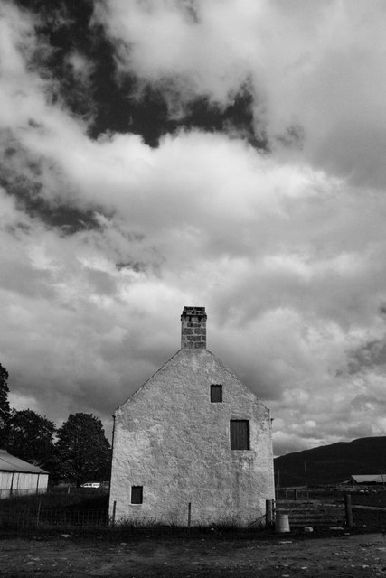
Garvamore Barracks
This former Kingshouse was used at one time as a keeper's house and is believed to have been a barracks for government troops stationed on the Corrieyairack pass. It was used by both soldiers and civilians who had to cross the pass. Once the Corrieyairack became a drove road, the drovers used Garvamore as a 'stance' for overnighting their cattle, as water and grazing were available. It is thought that the long two storey building dates from 1740. The building is listed Category A and is registered as a Building At Risk by the Scottish Civic Trust (2009).
 Map © Crown Copyright")
TIP: Click the map for more Large scale mapping
- Grid Square
- NN5294, 60 images (more nearby 🔍)
- Photographer
- Terry Levinthal (more nearby)
- Date Taken
- Monday, 20 July, 2009 (more nearby)
- Submitted
- Thursday, 15 October, 2009
- Subject Location
-
OSGB36:
 NN 528 943 [100m precision]
WGS84: 57:0.9774N 4:25.5328W - Camera Location
-
OSGB36: NN 527 943
- View Direction
- East-southeast (about 112 degrees)