2004
SU2002 : Pound Lane
taken 20 years ago, near to Burley, Hampshire, England
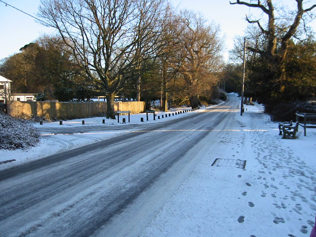
Pound Lane
Pound Lane, opposite the junction with Copse Road, looking towards Burley. Named after the pound where ponies and cattle were rounded up.
 Map © Crown Copyright")
TIP: Click the map for more Large scale mapping
- Grid Square
- SU2002, 38 images (more nearby 🔍)
- Photographer
- Kevin Danks (more nearby)
- Date Taken
- January 2004 (more nearby)
- Submitted
- Sunday, 5 June, 2005
- Subject Location
-
OSGB36:
 SU 208 027 [100m precision]
WGS84: 50:49.4243N 1:42.3130W - Camera Location
-
OSGB36: SU 208 027
- View Direction
- Northeast (about 45 degrees)