2009
NS8181 : Rock outcrop bearing cup-and-ring marks
taken 14 years ago, near to Head of Muir, Falkirk, Scotland
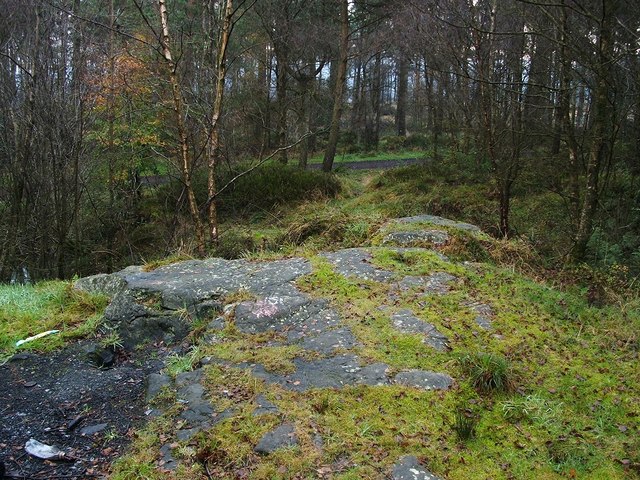
Rock outcrop bearing cup-and-ring marks
The rock outcrop shown here is located beside NS8181 : Footpath in Chacefield Wood; that path is visible in the background.
The marks on the rock are not visible from this distance, but they include (1) several sets of cup-and-ring markings – Link – at the upper right part of the outcrop (i.e., the part nearest the footpath), and (2) a cluster of cup marks – Link – on the part of the outcrop that is jutting out towards the left-hand edge of the photo.
The marks on the rock are not visible from this distance, but they include (1) several sets of cup-and-ring markings – Link – at the upper right part of the outcrop (i.e., the part nearest the footpath), and (2) a cluster of cup marks – Link – on the part of the outcrop that is jutting out towards the left-hand edge of the photo.
Chacefield Wood: cup-marked rock
Located near a footpath through Chacefield Wood.
 Map © Crown Copyright")
TIP: Click the map for more Large scale mapping
- Grid Square
- NS8181, 27 images (more nearby 🔍)
- Photographer
- Lairich Rig (more nearby)
- Date Taken
- Monday, 9 November, 2009 (more nearby)
- Submitted
- Tuesday, 10 November, 2009
- Subject Location
-
OSGB36:
 NS 8164 8128 [10m precision]
WGS84: 56:0.5875N 3:53.9944W - Camera Location
-
OSGB36: NS 8164 8128
- View Direction
- North-northeast (about 22 degrees)