2009
SK2324 : Dallow Lock No 7, Burton-upon- Trent
taken 15 years ago, near to Burton Upon Trent, Staffordshire, England
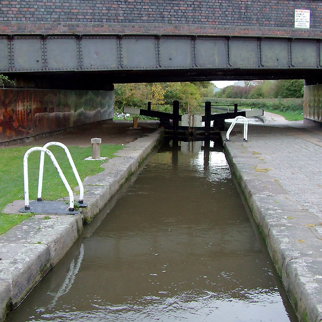
Dallow Lock No 7, Burton-upon- Trent
The Trent and Mersey Canal was surveyed in 1758, received its Act of Parliament in 1766, was completed and opened by 1777. The section through Burton was finished by 1770. The lock is not a deep one, dropping the water level by 3ft 6in (just over a metre). The bridge bears the number 32A, which suggests that either Dallow Street which crosses it was not in existence when the canal was built here, or that it was of no importance, the bridge being built and numbered at a later stage.
Apparently, until recently, the area was quite "unsavoury" (to put it politely) and anti-vandal locks were in place on the paddle winding gear. Now there are two seventy foot murals (by Matt Reeves from Birmingham) on the bridge walls, and on a brewing theme - and these haven't been defaced yet. Some wrought iron sculptures are on the fence by the lock overflow channel, and geese graze there. SK2324 : Geese (and friends) by Dallow Lock, Burton-upon-Trent
Apparently, until recently, the area was quite "unsavoury" (to put it politely) and anti-vandal locks were in place on the paddle winding gear. Now there are two seventy foot murals (by Matt Reeves from Birmingham) on the bridge walls, and on a brewing theme - and these haven't been defaced yet. Some wrought iron sculptures are on the fence by the lock overflow channel, and geese graze there. SK2324 : Geese (and friends) by Dallow Lock, Burton-upon-Trent
 Map © Crown Copyright")
TIP: Click the map for more Large scale mapping
- Grid Square
- SK2324, 48 images (more nearby 🔍)
- Photographer
- Roger D Kidd (more nearby)
- Date Taken
- Saturday, 17 October, 2009 (more nearby)
- Submitted
- Monday, 16 November, 2009
- Subject Location
-
OSGB36:
 SK 239 241 [100m precision]
WGS84: 52:48.8786N 1:38.7631W - Camera Location
-
OSGB36: SK 239 241
- View Direction
- Northeast (about 45 degrees)