2005
NJ7916 : Kintore Town Centre
taken 19 years ago, near to Kintore, Aberdeenshire, Scotland
This is 1 of 3 images, with title starting with Kintore Town in this square
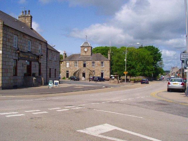
Kintore Town Centre
Kintore, a small town in East Aberdeenshire, situated close to the River Don. On the A96, 13 miles North-west of Aberdeen. The name Kintore comes from the Gaelic, Ceann-an-torr, "Ceann" means head or end, "Torr" means a round hill, the name signifies that the town was at the head or end of a round hill. Founded in the late 12th century as a royal burgh. The earliest Royal Charter was granted to Kintore in 1506 by King James IV. It was the fourth town in Scotland to be given a notarial charter
 Map © Crown Copyright")
TIP: Click the map for more Large scale mapping
- Grid Square
- NJ7916, 60 images (more nearby 🔍)
- Photographer
- Colin Walker (more nearby)
- Date Taken
- Monday, 6 June, 2005 (more nearby)
- Submitted
- Monday, 6 June, 2005
- Subject Location
-
OSGB36:
 NJ 79 16 [1000m precision]
WGS84: 57:14.3249N 2:20.4762W