2000
SH7113 : The shelter hut on Cadair Idris
taken 24 years ago, 3 km from Minffordd, Gwynedd, Wales
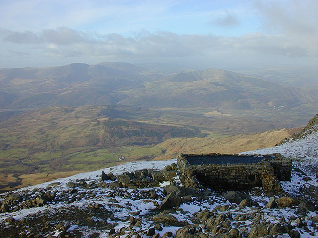
The shelter hut on Cadair Idris
A useful shelter from inclement weather, although on a fine but freezing day like this it can be colder inside than out; in this instance it did provide shelter from a penetrating wind. In the distance, the Rhinogydd and hills further north are enclosed in a frozen haze.
Incidentally, the name Penygadair which appears on maps refers to the hut (and to the tea room before it), not the summit.
Incidentally, the name Penygadair which appears on maps refers to the hut (and to the tea room before it), not the summit.
 Map © Crown Copyright")
TIP: Click the map for more Large scale mapping
- Grid Square
- SH7113, 160 images (more nearby 🔍)
- Photographer
- Nigel Brown (more nearby)
- Date Taken
- Sunday, 13 February, 2000 (more nearby)
- Submitted
- Friday, 11 December, 2009
- Subject Location
-
OSGB36:
 SH 711 131 [100m precision]
WGS84: 52:42.0337N 3:54.4702W - Camera Location
-
OSGB36: SH 711 131
- View Direction
- North-northwest (about 337 degrees)