2009
NG2354 : Waterfall in unnamed burn
taken 14 years ago, near to Claigan, Isle of Skye, Scotland
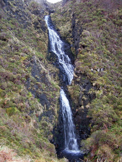
Waterfall in unnamed burn
This waterfall in an unnamed burn is not marked on the OS map.
The burn is flowing down the western side of Beinn Bhreac and meets the sea in Lovaig Bay.
The burn is flowing down the western side of Beinn Bhreac and meets the sea in Lovaig Bay.
 Map © Crown Copyright")
TIP: Click the map for more Large scale mapping
- Grid Square
- NG2354, 17 images (more nearby 🔍)
- Photographer
- Richard Dorrell (more nearby)
- Date Taken
- Friday, 11 December, 2009 (more nearby)
- Submitted
- Saturday, 12 December, 2009
- Subject Location
-
OSGB36:
 NG 237 549 [100m precision]
WGS84: 57:30.0175N 6:36.8386W - Camera Location
-
OSGB36: NG 237 549
- View Direction
- South-southwest (about 202 degrees)