2009
SJ9498 : Bank Top, Ashton-under-Lyne
taken 14 years ago, near to Ashton-Under-Lyne, Tameside, England
This is 1 of 6 images, with title starting with Bank Top in this square
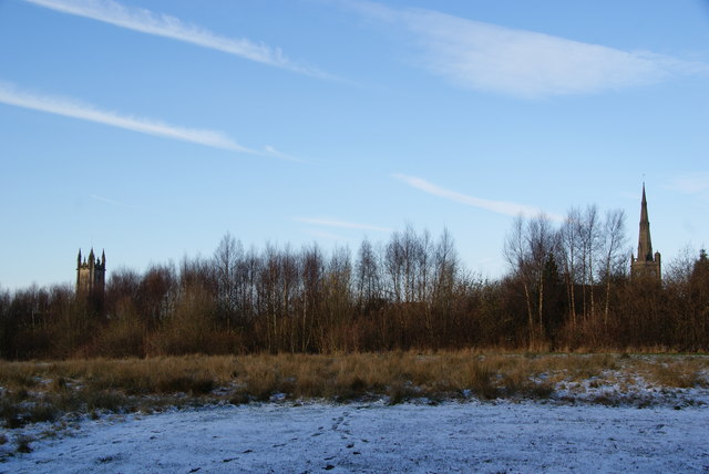
Bank Top, Ashton-under-Lyne
This is an area of raised land which was formerly a triangle between two branches of the railway. It is now just kept as open land but is off the beaten track. Two of Ashton's tall buildings are behind: St Michael's tower and Albion Church spire.
 Map © Crown Copyright")
TIP: Click the map for more Large scale mapping
- Grid Square
- SJ9498, 273 images (more nearby 🔍)
- Photographer
- Bill Boaden (more nearby)
- Date Taken
- Friday, 18 December, 2009 (more nearby)
- Submitted
- Saturday, 19 December, 2009
- Subject Location
-
OSGB36:
 SJ 943 987 [100m precision]
WGS84: 53:29.1153N 2:5.2058W - Camera Location
-
OSGB36: SJ 943 986
- View Direction
- North-northwest (about 337 degrees)