2009
TF6806 : St Martin's church
taken 14 years ago, near to Fincham, Norfolk, England
This is 1 of 2 images, with title St Martin's church in this square
St Martin's church
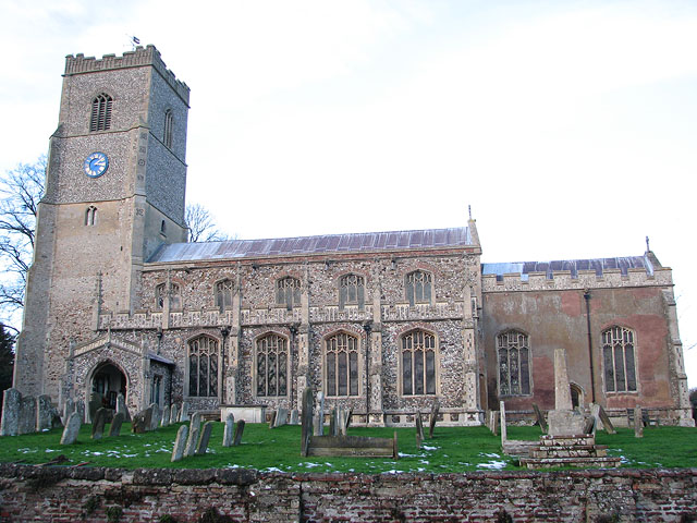
St Martin > Link - Link is one of formerly two churches in the village of Fincham. St Michael's church (abandoned in 1745 after the collapse of its tower) used to be situated about 200 metres to the west and after it was pulled down some of it was used to repair St Martin. The church sits on an elevation north of High Street, the main thoroughfare through the village. The building dates mainly from the 15th century but was restored in the mid to late 1800s when the south porch was added. The stained glass windows > Link date from that time also. The vestry on the north side dates from around 1503 and has an extra room above for the use of an assistant priest. The rood screen with its elaborately carved tracery and original painted decoration on the panels > Link is C15. The most notable feature of the church is the magnificent Norman font > Link which came from St Michael's church. It is only one of 13 square Norman fonts that still survive in north-west Norfolk and one of only three which have figures carved on the sides of the bowl. Six boards dating from 1717 and inscribed with texts from the Bible > Link hang on the nave walls. The pulpit and pews were installed in Victorian times.
 Map © Crown Copyright")
TIP: Click the map for more Large scale mapping
- Grid Square
- TF6806, 98 images (more nearby 🔍)
- Photographer
- Evelyn Simak (more nearby)
- Date Taken
- Saturday, 26 December, 2009 (more nearby)
- Submitted
- Monday, 28 December, 2009
- Subject Location
-
OSGB36:
 TF 688 064 [100m precision]
WGS84: 52:37.7892N 0:29.5785E - Camera Location
-
OSGB36: TF 688 064
- View Direction
- NORTH (about 0 degrees)