2009
TQ2105 : River Adur and railway bridge, near Shoreham, West Sussex
taken 14 years ago, near to Shoreham-by-Sea, West Sussex, England
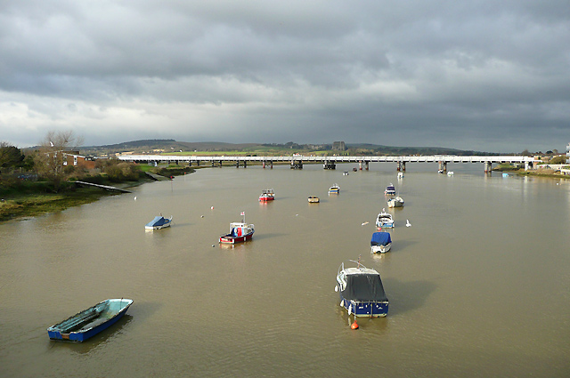
River Adur and railway bridge, near Shoreham, West Sussex
The sun came out for just about ten minutes, making the heavy clouds inland appear even more threatening. For centuries, the River Adur was navigable beyond this point as far as Steyning, but silting up of the channel meant the port was relocated at Shoreham. Recent decline in local industry has resulted in modern developments on the resulting brown-field sites, and bridges no longer need to allow the passage of large vessels.
The railway was opened through Shoreham in 1840, and a wooden trestle bridge subsequently carried it west across the river from 1845 until 1911, when this steel structure replaced it. It now carries the West Coastway Line between Southampton and Brighton.
The railway was opened through Shoreham in 1840, and a wooden trestle bridge subsequently carried it west across the river from 1845 until 1911, when this steel structure replaced it. It now carries the West Coastway Line between Southampton and Brighton.
 Map © Crown Copyright")
TIP: Click the map for more Large scale mapping
- Grid Square
- TQ2105, 463 images (more nearby 🔍)
- Photographer
- Roger D Kidd (more nearby)
- Date Taken
- Thursday, 31 December, 2009 (more nearby)
- Submitted
- Tuesday, 5 January, 2010
- Subject Location
-
OSGB36:
 TQ 210 051 [100m precision]
WGS84: 50:49.9937N 0:16.9194W - Camera Location
-
OSGB36: TQ 212 050
- View Direction
- Northwest (about 315 degrees)