2010
SX8672 : Newton Abbot's canal history
taken 14 years ago, near to Newton Abbot, Devon, England
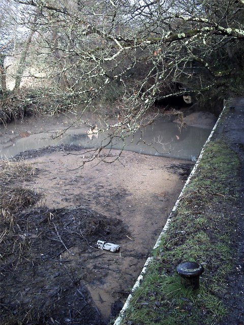
Newton Abbot's canal history
This is the old Stover canal basin at Newton Abbot. It is part of the ancient Templer Way of some 18 miles between Haytor on Dartmoor and Teignmouth on the south coast. The Way traces the route by which granite was exported from Dartmoor via the unique Haytor Granite Tramway and the Stover Canal and is comprehensively way-marked except on the open moor. For most of its route it is well looked after, EXCEPT here in Newton Abbot where it is left to rot. This photo shows the canal basin and the later tunnel under the single track railway (now disused) to Heathfield. The basin is now full of rubbish, even a discarded VHS video camera.
 Map © Crown Copyright")
TIP: Click the map for more Large scale mapping
- Grid Square
- SX8672, 114 images (more nearby 🔍)
- Photographer
- Anthony Volante (more nearby)
- Date Taken
- Wednesday, 13 January, 2010 (more nearby)
- Submitted
- Wednesday, 13 January, 2010
- Subject Location
-
OSGB36:
 SX 861 722 [100m precision]
WGS84: 50:32.3068N 3:36.5201W - Camera Location
-
OSGB36: SX 861 722
- View Direction
- Northeast (about 45 degrees)