2010
NS3878 : Remains of Nether Dalquhurn Farm
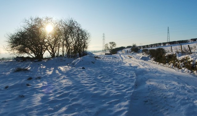
taken 14 years ago, near to Renton, West Dunbartonshire, Scotland
This is 1 of 3 images, with title Remains of Nether Dalquhurn Farm in this square
Remains of Nether Dalquhurn Farm
A farm track, with some woods on its eastern side, leads south towards this site; where the track leaves the woods behind, there is a modern metal gate. Beyond that gate, there is an open space to the east of the track, as shown here. A few mounds, consisting of earth and rubble, are the visible remains of Nether Dalquhurn Farm, which is shown in an 1864 OS map of this area (based on surveys carried out in 1860); in 1858, it was being farmed by George Kinloch.
For another view, see NS3878 : Remains of Nether Dalquhurn Farm. For a view of the same mounds later in the year, see NS3878 : Remains of Nether Dalquhurn Farm.
The land that was associated with this farm is now included in that of NS3878 : Upper Dalquhurn Farm, which is located just a short distance to the north.
The Pont/Blaeu map of the Lennox (published in 1654, but based on surveys carried out in about the 1580s-90s) shows "N. Dalwhurn" (Nether Dalquhurn), with "O. Dalwhurn" (Over Dalquhurn) just to the north; the latter corresponds to the present-day Upper Dalquhurn Farm.
The Lennox Cartulary contains a charter by Malcolm Earl of Lennox (14th century), granting the land of "Dalchorne" to Walter Sprewl. For more on this (and subsequent ownership), see NS3977 : The former site of Dalquhurn House.
Nether Dalquhurn Farm
A Nether Dalquhurn farm is shown on a map surveyed in the late sixteenth century. It was in use until the nineteenth century, but is now represented only by ruins.
 Map © Crown Copyright")
TIP: Click the map for more Large scale mapping
- Grid Square
- NS3878, 296 images (more nearby 🔍)
- Photographer
- Lairich Rig (more nearby)
- Date Taken
- Friday, 8 January, 2010 (more nearby)
- Submitted
- Wednesday, 13 January, 2010
- Subject Location
-
OSGB36:
 NS 3827 7806 [10m precision]
WGS84: 55:58.0932N 4:35.5722W - Camera Location
-
OSGB36: NS 3828 7809
- View Direction
- South-southwest (about 202 degrees)