2008
NC4932 : Flat, almost featureless bogland to the east of Meall an Amairich
taken 16 years ago, 5 km SW of Mudale, Highland, Scotland
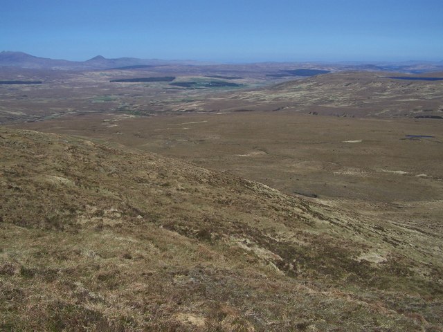
Flat, almost featureless bogland to the east of Meall an Amairich.
The plantations around Mudale (middle) and the hill of Ben Loyal (extreme left) in the background.
 Map © Crown Copyright")
TIP: Click the map for more Large scale mapping
- Grid Square
- NC4932 (more nearby 🔍)
- Photographer
- Nick Lindsay (more nearby)
- Date Taken
- Tuesday, 13 May, 2008 (more nearby)
- Submitted
- Wednesday, 27 January, 2010
- Subject Location
-
OSGB36:
 NC 496 326 [100m precision]
WGS84: 58:15.4222N 4:33.8287W - Camera Location
-
OSGB36: NC 490 324
- View Direction
- East-northeast (about 67 degrees)