2005
NC6034 : A shieling on the SE bank of Allt Creagach, east of Clebrig Farm
taken 19 years ago, near to Clebrig, Highland, Scotland
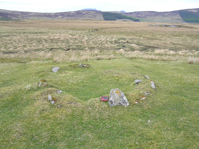
A shieling on the SE bank of Allt Creagach, east of Clebrig Farm.
It is one of 5 in this pre-clearance shieling township, enclosed by a head dyke and there is also an Iron/Bronze Age hut circle on this site.
 Map © Crown Copyright")
TIP: Click the map for more Large scale mapping
- Grid Square
- NC6034 (more nearby 🔍)
- Photographer
- Nick Lindsay (more nearby)
- Date Taken
- Saturday, 14 May, 2005 (more nearby)
- Submitted
- Sunday, 31 January, 2010
- Subject Location
-
OSGB36:
 NC 606 343 [100m precision]
WGS84: 58:16.5382N 4:22.6731W - Camera Location
-
OSGB36: NC 606 343
- View Direction
- North-northwest (about 337 degrees)