2010
NS4278 : Concrete blocks
taken 14 years ago, near to Bonhill, West Dunbartonshire, Scotland
Concrete blocks
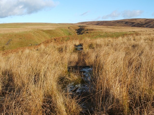
Although the low sun of a late winter afternoon means that they cannot be seen particularly well here among the vegetation, the photo shows two long concrete blocks, set almost end-to-end, oriented along the line of sight; each measures about 6.5m×0.9m.
Given that similar blocks can be seen in a Second World War decoy site nearby, it seems likely that these blocks are also military remains from that period; see NS4278 : Corner of enclosure for further discussion, and Link for details of the decoy site itself.
The upper reaches of Auchenreoch Glen can be seen in the background, turning to continue along the line of the blocks.
Auchenreoch Starfish decoy :: NS4277
During the Second World War, so-called Starfish decoys were carefully designed to provide very convincing false targets for enemy bombers. See Link
(at Secret Scotland) for a full explanation; Link
 Map © Crown Copyright")
TIP: Click the map for more Large scale mapping
- Grid Square
- NS4278, 100 images (more nearby 🔍)
- Photographer
- Lairich Rig (more nearby)
- Date Taken
- Friday, 29 January, 2010 (more nearby)
- Submitted
- Wednesday, 3 February, 2010
- Subject Location
-
OSGB36:
 NS 4205 7819 [10m precision]
WGS84: 55:58.2388N 4:31.9469W - Camera Location
-
OSGB36: NS 4204 7818
- View Direction
- Northeast (about 45 degrees)