2010
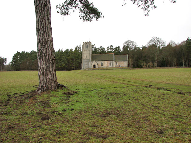
TL9785 : The church of All Saints
taken 14 years ago, near to Middle Harling, Norfolk, England
This is 1 of 4 images, with title The church of All Saints in this square

The church of All Saints
All Saints' church > Link was built during the 13th century with its tower added a century later. The church was extensively restored in Victorian times but has retained a number of mediaeval survivals such as the octagonal font > Link and stained glass > Link from the 15th century Norwich School. There are also a few figure brasses, one depicting a priest in mass vestments > Link. What appears to be medieval panels have been incorporated into the C20 reredos > Link. The church has been redundant for the past three decades and is in the care of the Churches Conservation Trust.
West Harling, a village in the Thet valley, was deserted in the first half of the 18th century. Originally part of a cluster of settlements which all had the name 'Herlinga' in 1086, three of these had become known as West Harling (with its church of All Saints'), Middle Harling (with St Andrew's church) and Harling Thorpe. Middle Harling became part of West Harling parish in 1543. With a new Lord of the Manor, Richard Gipps, the fate of the until then fairly prosperous villages changed: Gipps bought all the houses except for one small cottage and so had reduced the number of dwellings. Gipps' heirs closed the old road, and the foundations of the demolished church in Middle Harling were uprooted to build up a marshy ground. All Saints church today stands isolated, the Hall built by Gipps was demolished in 1931 and conifer plantations cover much of his estate. What remains is a bust in the church Link placed there by his great-nephew.
West Harling, a village in the Thet valley, was deserted in the first half of the 18th century. Originally part of a cluster of settlements which all had the name 'Herlinga' in 1086, three of these had become known as West Harling (with its church of All Saints'), Middle Harling (with St Andrew's church) and Harling Thorpe. Middle Harling became part of West Harling parish in 1543. With a new Lord of the Manor, Richard Gipps, the fate of the until then fairly prosperous villages changed: Gipps bought all the houses except for one small cottage and so had reduced the number of dwellings. Gipps' heirs closed the old road, and the foundations of the demolished church in Middle Harling were uprooted to build up a marshy ground. All Saints church today stands isolated, the Hall built by Gipps was demolished in 1931 and conifer plantations cover much of his estate. What remains is a bust in the church Link placed there by his great-nephew.
