2010
NN5622 : Forest Edge in Glen Kendrum
taken 14 years ago, near to Auchtubh, Stirling, Scotland
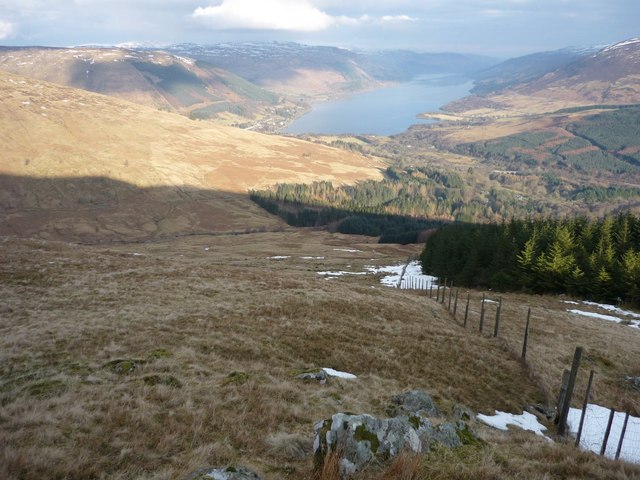
Forest Edge in Glen Kendrum
The forest on Auchtubhmore Hill runs down into Glen Kendrum, with Loch Earn in the distance.
 Map © Crown Copyright")
TIP: Click the map for more Large scale mapping
- Grid Square
- NN5622, 2 images (more nearby 🔍)
- Photographer
- Gordon Morrison (more nearby)
- Date Taken
- Thursday, 18 February, 2010 (more nearby)
- Submitted
- Thursday, 18 February, 2010
- Subject Location
-
OSGB36:
 NN 566 224 [100m precision]
WGS84: 56:22.3647N 4:19.3282W - Camera Location
-
OSGB36: NN 561 223
- View Direction
- East-northeast (about 67 degrees)