2010
TR0133 : Unused kissing gate on the Royal Military Canal Path
taken 14 years ago, near to Ruckinge, Kent, England
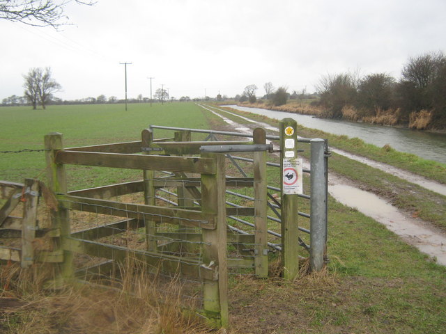
Unused kissing gate on the Royal Military Canal Path
The long distance path heads on a farm track beside the canal towards Hamstreet from Marsh Road, near Ruckinge.
Royal Military Canal
The Royal Military Canal stretches for 28 miles hugging the old cliff line that borders the Romney Marsh from Hythe in the north east to Cliff End in the south west. It was built as a third line of defence against Napoleon, after the British Royal Navy patrolling the English Channel and the line of 74 Martello Towers built along the south coast. The Royal Military Canal was constructed in two sections. The longest section starts at Hythe in Kent and ends at Iden Lock in East Sussex. The second smaller section runs from the foot of Winchelsea Hill to Cliff End. Both sections are linked by the Rivers Rother and Brede.
See Linkand Link
 Map © Crown Copyright")
TIP: Click the map for more Large scale mapping
- Grid Square
- TR0133, 25 images (more nearby 🔍)
- Photographer
- David Anstiss (more nearby)
- Date Taken
- Sunday, 21 February, 2010 (more nearby)
- Submitted
- Tuesday, 23 February, 2010
- Subject Location
-
OSGB36:
 TR 019 330 [100m precision]
WGS84: 51:3.6491N 0:52.8182E - Camera Location
-
OSGB36: TR 019 330
- View Direction
- West-southwest (about 247 degrees)