2010
TQ9350 : Bus Shelter Charing Heath Road
taken 14 years ago, near to Charing Heath, Kent, England
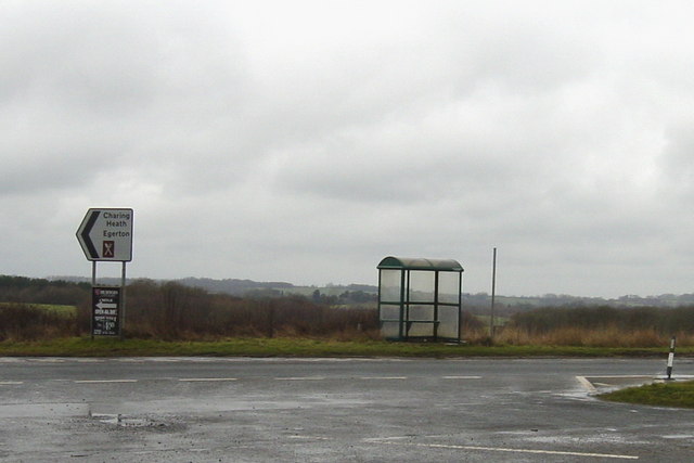
Bus Shelter Charing Heath Road
Modern shelter at the 510 stop towards Maidstone, convenient for the caravan park almost opposite. The metal pole at present has no flag, and the shelter is devoid of timetables and other notices. Behind it the view towards the Weald stretches away.
 Map © Crown Copyright")
TIP: Click the map for more Large scale mapping
- Grid Square
- TQ9350, 35 images (more nearby 🔍)
- Photographer
- Mike Sharpe (more nearby)
- Date Taken
- Thursday, 25 February, 2010 (more nearby)
- Submitted
- Thursday, 25 February, 2010
- Subject Location
-
OSGB36:
 TQ 938 502 [100m precision]
WGS84: 51:13.0903N 0:46.4639E - Camera Location
-
OSGB36: TQ 939 502
- View Direction
- West-southwest (about 247 degrees)