2010
NY9565 : Anick Grange and the Tyne valley
taken 17 years ago, near to Oakwood, Northumberland, England
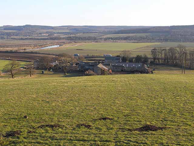
Anick Grange and the Tyne valley
Anick Grange from the east end of Anick village. The back road (Corchester Lane) between Hexham and Corbridge runs just beyond, with the main A69 road (where two lorries are visible) a little further away. A reach of River Tyne can be seen in the floor of the valley with the valley of the tributary Devil's Water on the far side. Dipton Wood occupies the hilltop to the left. In the foreground, a very sick rabbit (myxamatosed?).


TIP: Click the map for more Large scale mapping
- Grid Square
- NY9565, 48 images (more nearby 🔍)
- Photographer
- Oliver Dixon (more nearby)
- Date Taken
- Thursday, 4 March, 2010 (more nearby)
- Submitted
- Friday, 5 March, 2010
- Subject Location
-
OSGB36:
 NY 957 653
[100m precision]
WGS84: 54:58.9531N 2:4.0389W - Camera Location
-
OSGB36:
NY 956 656
- View Direction
- South-southeast (about 157 degrees)


