2010
NZ2363 : Clumber Street, Cruddas Park
taken 14 years ago, near to Dunston, Gateshead, England
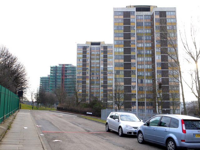
Clumber Street, Cruddas Park
Cruddas Park NZ2363 : Cruddas Park was named after George Cruddas who was a Director of the Armstrong armament works on Scotswood Road and lived nearby in Dene House. The high rises of Cruddas Park were part of T. Dan Smith's 1960's development, 'City in the Sky', famously used in the BBC series, 'Our Friends in the North', Link
There is an aerial photo taken just after completion of Cruddas Park in 31st July 1963 here Link
The story of Cruddas Park can be read here Link
The multi-million pound renovation of the blocks (to be named Riverside Dene) in 2009-2012 is outlined here Link
Cruddas Park is one of the areas featured in a Newcastle upon Tyne residential areas case study on Kay's Geography site Link
Chronicle News (May 3rd 2010) 'New Cruddas Park homes are a towering success' Link
Chronicle News (June 2nd 2010) 'Families return after Cruddas Park revamp' Link
Five of the 10 high-rise blocks (The Poplars, The Willows, The Beeches, Haughton Court and Kings Meadows) are now to be demolished to make way for new homes after private developers pulled out of the scheme.
Chronicle News (October 28th 2010) 'Cruddas Park flats will now be demolished' Link
Old Cruddas Park tower now luxury homes
Link
See other images of Cruddas Park
 Map © Crown Copyright")
TIP: Click the map for more Large scale mapping
- Grid Square
- NZ2363, 128 images (more nearby 🔍)
- Photographer
- Andrew Curtis (more nearby)
- Date Taken
- Thursday, 11 March, 2010 (more nearby)
- Submitted
- Thursday, 11 March, 2010
- Subject Location
-
OSGB36:
 NZ 2319 6336 [10m precision]
WGS84: 54:57.8600N 1:38.3604W - Camera Location
-
OSGB36: NZ 2316 6336
- View Direction
- EAST (about 90 degrees)