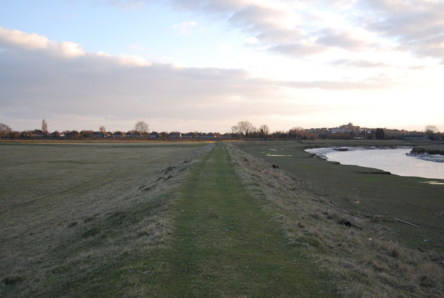
TQ9221 : Flood embankment along the River Rother
taken 14 years ago, near to East Guldeford, East Sussex, England
The Sussex Border Path is a footpath route nearly 150 miles long around the inland boundary of the county of Sussex. The county owes its origins to the kingdom of the South Saxons and can claim to have one of the longest inland county boundaries from Emsworth to Rye. The route was devised in 1983 and is well signed along most of the route. Website Link

Map: Link
The Saxon Shore Way starts at Gravesend, Kent and traces the coast as it was in the Roman times as far as Hastings in East Sussex, 163 miles (262 km) in total. The Saxon Shore Way was originally opened in 1980, but has since been re-established, and in parts re-routed and extended. It follows the coastline of the South East as it was about 1500 years ago, long before the North Kent Marshes or the Romney Marsh came into existence. The Way takes its name, The Saxon Shore, from a line of fortifications built along the coastline as it was in the 3rd Century AD.
The River Rother runs for 35 miles from Rotherfield, East Sussex, entering Kent after Bodiam where it follows the county border to Wittersham, where it rejoins East Sussex to the mouth at Rye.
There are two other River Rothers in Yorkshire and in Hampshire to West Sussex.
 Map © Crown Copyright")
- Grid Square
- TQ9221, 164 images (more nearby 🔍)
- Photographer
- N Chadwick (more nearby)
- Date Taken
- Saturday, 6 March, 2010 (more nearby)
- Submitted
- Monday, 15 March, 2010
- Subject Location
-
OSGB36:
 TQ 927 213 [100m precision]
WGS84: 50:57.5501N 0:44.5535E - Camera Location
-
OSGB36: TQ 927 213
- View Direction
- South-southwest (about 202 degrees)