2010
SP1058 : Ancient pond
taken 14 years ago, near to Alne End, Warwickshire, England
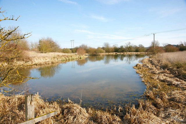
Ancient pond
This pond, perhaps a former fishpond, forms part of a series of archaeological lumps, bumps and other features in this part of Kinwarton and lies next to the National Trust-operated Kinwarton Dovecot.
 Map © Crown Copyright")
TIP: Click the map for more Large scale mapping
- Grid Square
- SP1058, 43 images (more nearby 🔍)
- Photographer
- Colin Craig (more nearby)
- Date Taken
- Tuesday, 16 March, 2010 (more nearby)
- Submitted
- Tuesday, 16 March, 2010
- Subject Location
-
OSGB36:
 SP 106 584 [100m precision]
WGS84: 52:13.4654N 1:50.7218W - Camera Location
-
OSGB36: SP 106 585
- View Direction
- South-southeast (about 157 degrees)