NZ2664 : Archway, Dalton Street
taken 14 years ago, near to Byker, Newcastle Upon Tyne, England
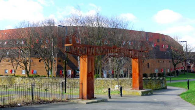
The Byker Wall is the name given to the long, curving blocks of maisonettes of between 3 and 8-storeys built as a protective wall on the north side of Byker Estate. South of the wall, short, low-rise terraces are arranged in small communities often utilising the same bold elements (colour coded in regions) around play-grounds, greens and well planted gardens. It was designed by the notable architect Ralph Erskine (1914-2005) Link
during the mid-1970s. Its Functionalist Romantic styling with textured, complex facades, colourful brick, wood and plastic panels, attention to context and relatively low-rise construction represented a major break with the Brutalist high-rise architecture in favour at the time. The innovative and visionary design has won many awards, and the Byker Wall has also been placed on UNESCO's list of outstanding twentieth century buildings. In 2007 the Byker Estate was Grade II* listed as an example of outstanding architecture Link
A case study of Byker Estate by Future Communities can be found here Link
Municipal Dreams in Housing, Newcastle Link
 Map © Crown Copyright")
- Grid Square
- NZ2664, 484 images (more nearby 🔍)
- Photographer
- Andrew Curtis (more nearby)
- Date Taken
- Sunday, 28 March, 2010 (more nearby)
- Submitted
- Sunday, 28 March, 2010
- Subject Location
-
OSGB36:
 NZ 2672 6458 [10m precision]
WGS84: 54:58.5073N 1:35.0458W - Camera Location
-
OSGB36: NZ 2673 6458
- View Direction
- Southwest (about 225 degrees)