NZ2664 : Hotel du Vin, City Road
taken 17 years ago, near to Byker, Newcastle Upon Tyne, England
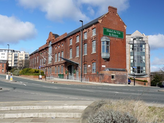
Newcastle's Victoria Tunnel runs beneath the hotel building. There is an entrance behind from Ouse Street Link

On the left, are the modern apartments at Lime Square with the edge of the former red-brick electricity substation just in front, now converted to offices.
The corner of the hotel wall on Ouse Street carries a Newcastle City Council commemorative plaque to the Craig family erected in 2009. The Craigs worked as watermen along the riverside in the mid C19th and came to be described in a newspaper of the time as 'the pluckiest family of lifesavers in the kingdom'. Between them they rescued about 25 people from drowning in the Rivers Tyne and Ouseburn. James Craig was known as the 'Ouseburn hero' and personally saved around 20 people. He carried out a double rescue in 1869 of both a 3 year old child and a man. He won a Royal Humane Society silver award in 1882 when, aged 53, he jumped 18 feett from a window in his home, and scaled two high walls, to save a man from drowning.
Link
(Archive Link ) The area beside the Ouse Burn north of its junction with the River Tyne was the cradle of the Industrial Revolution in Newcastle and was once home to many thriving (and very dirty) heavy crafts and industries. It fell into disuse and dereliction by the mid-twentieth century. The incarnation of the Valley in 1996 as a cultural regeneration hotspot was initiated by the Ouseburn Trust, in partnership with the local authority. The Trust remains a landlord and developer in the Ouseburn, and seeks to involve people in the heritage and regeneration of the area through its programme of free walks, talks and volunteering activities.
The river was previously tidal from roughly below Byker Bridge, revealing dark mud at low tide. The Ouseburn tidal barrage at the river mouth, which was completed in 2009, now retains high water in the Ouseburn at low tide, with the objective of providing a pleasanter environment alongside its banks at low tide, thus promoting development.
Tyne and Wear HER(11417): Ouseburn, Lower Ouseburn Valley Conservation Area Link
Wikipedia: Link
Ouseburn Trust: Link
Ouseburn Walk: Link
National Trail Lower Ouseburn Walk: Link
Old Ouseburn pubs Link
Ouseburn's Industrial Past Link


- Grid Square
- NZ2664, 540 images (more nearby 🔍)
- Photographer
- Andrew Curtis (more nearby)
- Date Taken
- Sunday, 28 March, 2010 (more nearby)
- Submitted
- Monday, 29 March, 2010
- Subject Location
-
OSGB36:
 NZ 2630 6422
[10m precision]
WGS84: 54:58.3145N 1:35.4414W - Camera Location
-
OSGB36:
NZ 2633 6418
- View Direction
- Northwest (about 315 degrees)


