2010
TM3877 : New Reach, Halesworth
taken 14 years ago, near to Halesworth, Suffolk, England
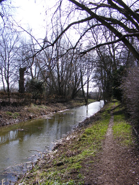
New Reach, Halesworth
Looking towards Millennium Green the New Reach is a canal constructed in the mid 18th Century as part of the Blyth Navigation that enabled wherries to travel between Southwold Harbour and Halesworth.
Halesworth footpath no.10
Link (Archive Link )
Halesworth footpath no.10
Link
 Map © Crown Copyright")
TIP: Click the map for more Large scale mapping
- Grid Square
- TM3877, 1015 images (more nearby 🔍)
- Photographer
- Geographer (more nearby)
- Date Taken
- Tuesday, 23 March, 2010 (more nearby)
- Submitted
- Tuesday, 30 March, 2010
- Subject Location
-
OSGB36:
 TM 38865 77520 [1m precision]
WGS84: 52:20.6216N 1:30.3226E - Camera Location
-
OSGB36: TM 38865 77520
- View Direction
- South-southeast (about 157 degrees)