2010
NY7273 : End of the motorable road, Grindon Green
taken 14 years ago, 5 km WSW of Whygate, Northumberland, England
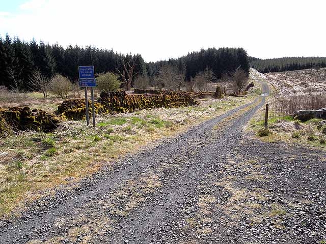
End of the motorable road, Grindon Green
An old public road runs from Stonehaugh through to Edges Green. Although the surface has been improved in recent years, it is still not suitable for cars. The road is followed by National Cycle Network route 68 (Pennine Cycleway).
 Map © Crown Copyright")
TIP: Click the map for more Large scale mapping
- Grid Square
- NY7273, 31 images (more nearby 🔍)
- Photographer
- Oliver Dixon (more nearby)
- Date Taken
- Monday, 26 April, 2010 (more nearby)
- Submitted
- Wednesday, 28 April, 2010
- Subject Location
-
OSGB36:
 NY 729 735 [100m precision]
WGS84: 55:3.3579N 2:25.4705W - Camera Location
-
OSGB36: NY 729 736
- View Direction
- South-southwest (about 202 degrees)