2010
NG2563 : Ruin in Sròn Ocrhulan
taken 14 years ago, 3 km from Geary, Isle of Skye, Scotland
This is 1 of 2 images, with title Ruin in Sròn Ocrhulan in this square
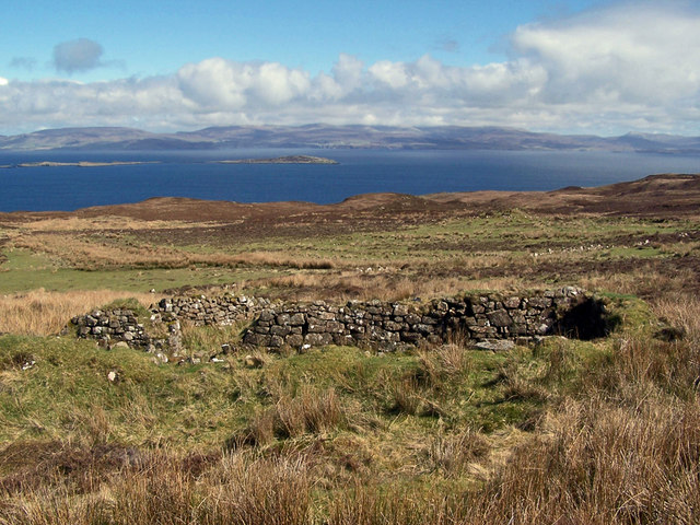
Ruin in Sròn Ocrhulan
There are ruins of several large buildings to be found in this deserted and ruined township.
Sròn Ocrhulan ruined township
Sròn Ocrhulan takes its name from the hillside on which it was built. It was a township of at least eight houses, located a mile or so north of the existing township of Gillen on the eastern side of the Waternish peninsula. Sròn Ocrhulan included a large area of cultivated land enclosed by stone and earth walls. All is now deserted and ruined, though the once cultivated lands still stand out as an area of short green grass among the deep heather and moss which covers the majority of the Waternish peninsula.
 Map © Crown Copyright")
TIP: Click the map for more Large scale mapping
- Grid Square
- NG2563, 9 images (more nearby 🔍)
- Photographer
- Richard Dorrell (more nearby)
- Date Taken
- Friday, 7 May, 2010 (more nearby)
- Submitted
- Friday, 7 May, 2010
- Subject Location
-
OSGB36:
 NG 2575 6389 [10m precision]
WGS84: 57:34.8896N 6:35.3965W - Camera Location
-
OSGB36: NG 2574 6389
- View Direction
- East-southeast (about 112 degrees)