2010
SP5007 : Oxford, Walton Well Road canal bridge
taken 14 years ago, near to Oxford, Oxfordshire, England
Oxford, Walton Well Road canal bridge
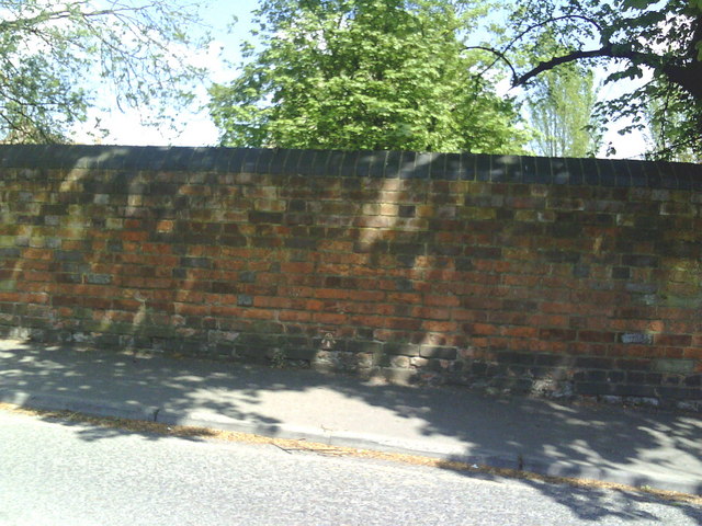
North parapet wall of bridge taking Walton Well Road over Oxford Canal. On the bridge is an Ordnance Survey cut mark benchmark which is described on the Bench Mark Database at Link .
.
 Map © Crown Copyright")
TIP: Click the map for more Large scale mapping
- Grid Square
- SP5007, 512 images (more nearby 🔍)
- Photographer
- Roger Templeman (more nearby)
- Date Taken
- Wednesday, 12 May, 2010 (more nearby)
- Submitted
- Thursday, 13 May, 2010
- Subject Location
-
OSGB36:
 SP 5041 0731 [10m precision]
WGS84: 51:45.7327N 1:16.2590W - Camera Location
-
OSGB36: SP 5041 0731
- View Direction
- NORTH (about 0 degrees)