2010
NH6567 : Burbridge navigation buoy, Cromarty Firth
taken 14 years ago, near to Dalmore, Highland, Scotland
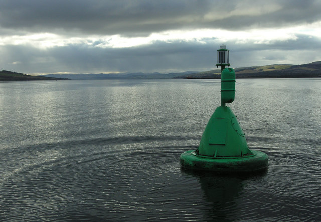
Burbridge navigation buoy, Cromarty Firth
The green starboard-hand navigation buoy assists shipping coming from and going to Highland Deephaven. Incidentally, Highland Deephaven can be seen just to the left of the green buoy and the red Cullicudden buoy can be seen just below the headland coming in from the Black Isle on the left.
 Map © Crown Copyright")
TIP: Click the map for more Large scale mapping
- Grid Square
- NH6567, 31 images (more nearby 🔍)
- Photographer
- George Brown (more nearby)
- Date Taken
- Wednesday, 10 February, 2010 (more nearby)
- Submitted
- Sunday, 30 May, 2010
- Subject Location
-
OSGB36:
 NH 65777 67272 [1m precision]
WGS84: 57:40.5136N 4:15.1361W - Camera Location
-
OSGB36: NH 65795 67276
- View Direction
- West-southwest (about 247 degrees)