2006
SD9435 : Boundary Stone looking down Hole Syke
taken 18 years ago, 4 km SSE of Wycoller, Lancashire, England
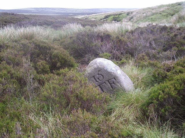
Boundary Stone looking down Hole Syke
Taken from the Lancashire side looking into Yorkshire
 Map © Crown Copyright")
TIP: Click the map for more Large scale mapping
- Grid Square
- SD9435, 10 images (more nearby 🔍)
- Photographer
- tim (more nearby)
- Date Taken
- Saturday, 24 June, 2006 (more nearby)
- Submitted
- Saturday, 24 June, 2006
- Subject Location
-
OSGB36:
 SD 942 355 [100m precision]
WGS84: 53:48.9449N 2:5.3744W - Camera Location
-
OSGB36: SD 941 355
- View Direction
- Southeast (about 135 degrees)