2006
SX8454 : Barberry Cross
taken 18 years ago, near to East Cornworthy, Devon, England
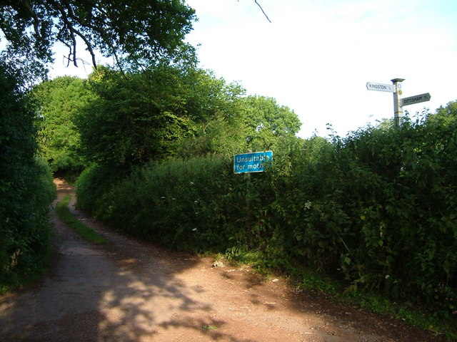
Barberry Cross
A T junction in the Barberry Water valley near East Cornworthy, although, as the sign points out, you'd be unwise to try driving straight on in most vehicles. That's Broadridge Lane, used by the Dart Valley Trail and the John Musgrave Heritage Trail and leading to Barberry Water Bridge and Tideford.
 Map © Crown Copyright")
TIP: Click the map for more Large scale mapping
- Grid Square
- SX8454, 37 images (more nearby 🔍)
- Photographer
- Derek Harper (more nearby)
- Date Taken
- Friday, 23 June, 2006 (more nearby)
- Submitted
- Sunday, 25 June, 2006
- Subject Location
-
OSGB36:
 SX 8421 5470 [10m precision]
WGS84: 50:22.8456N 3:37.7946W - View Direction
- WEST (about 270 degrees)