2009
TA1381 : Filey Brigg - Washer Brigg and High Brigg
taken 15 years ago, near to Filey, North Yorkshire, England
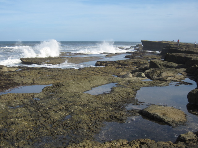
Filey Brigg - Washer Brigg and High Brigg
According to the mapping site magic.defra.gov.uk this area of rock pools is named Washer Brigg. The higher rock ledges beyond seem to be (unsurprisingly) High Brigg.
Filey Brigg can be covered with water at high tide or in bad weather so no-one should venture out there without first checking the tide times.
Filey Brigg can be covered with water at high tide or in bad weather so no-one should venture out there without first checking the tide times.
 Map © Crown Copyright")
TIP: Click the map for more Large scale mapping
- Grid Square
- TA1381, 113 images (more nearby 🔍)
- Photographer
- John S Turner (more nearby)
- Date Taken
- Monday, 5 October, 2009 (more nearby)
- Submitted
- Friday, 18 June, 2010
- Subject Location
-
OSGB36:
 TA 1342 8145 [10m precision]
WGS84: 54:12.9741N 0:15.7287W - Camera Location
-
OSGB36: TA 1330 8144
- View Direction
- EAST (about 90 degrees)