2010
SU9778 : Pocock's Lane
taken 14 years ago, near to Eton, Windsor And Maidenhead, England
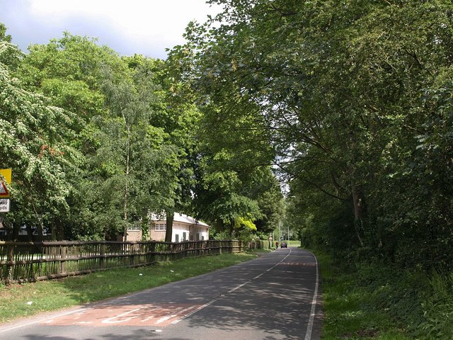
Pocock's Lane
This is the B3026 from Eton to Datchet. On the right, the Willow Brook, amongst trees, separates it from the Upper Club cricket ground. On the left is a pavilion at the entrance to Agars Plough playing fields.
 Map © Crown Copyright")
TIP: Click the map for more Large scale mapping
- Grid Square
- SU9778, 82 images (more nearby 🔍)
- Photographer
- Derek Harper (more nearby)
- Date Taken
- Sunday, 13 June, 2010 (more nearby)
- Submitted
- Friday, 18 June, 2010
- Subject Location
-
OSGB36:
 SU 9716 7830 [10m precision]
WGS84: 51:29.7182N 0:36.1082W - Camera Location
-
OSGB36: SU 9705 7834
- View Direction
- East-southeast (about 112 degrees)