2010
SH4490 : Mynydd Parys
taken 14 years ago, near to Gadfa, Isle of Anglesey/Sir Ynys Mon, Wales
This is 1 of 4 images, with title Mynydd Parys in this square
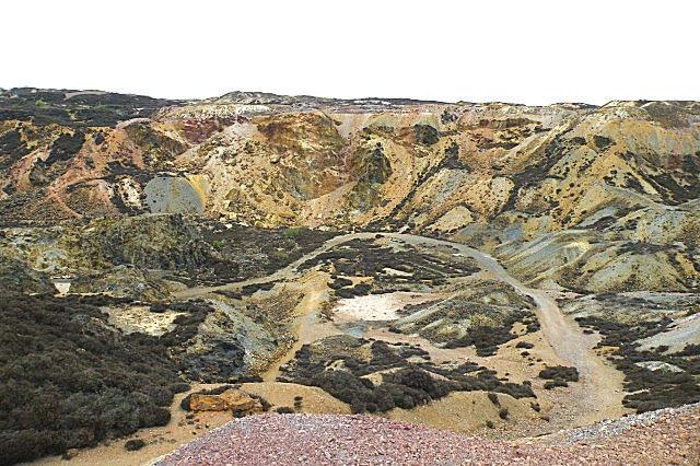
Mynydd Parys
This is the continuation to the right of SH4490 : Mynydd Parys, and helps to give an idea of the size of the hole.
 Map © Crown Copyright")
TIP: Click the map for more Large scale mapping
- Grid Square
- SH4490, 157 images (more nearby 🔍)
- Photographer
- Anne Burgess (more nearby)
- Date Taken
- Wednesday, 19 May, 2010 (more nearby)
- Submitted
- Tuesday, 29 June, 2010
- Subject Location
-
OSGB36:
 SH 440 902 [100m precision]
WGS84: 53:23.1608N 4:20.7439W - Camera Location
-
OSGB36: SH 441 901
- View Direction
- Northwest (about 315 degrees)