2006
SE2320 : Upstream end of flood channel, Dewsbury
taken 18 years ago, near to Ravensthorpe, Kirklees, England
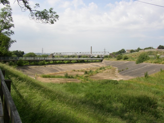
Upstream end of flood channel, Dewsbury
This channel is along the former Dewsbury Canal, which was made redundant when the canal through Thornhill Lees was constructed. The towing path is a public footpath, so a footbridge was constructed to carry it over the channel. This photo was taken from the Calder Valley Greenway, along the path behind Island View.
 Map © Crown Copyright")
TIP: Click the map for more Large scale mapping
- Grid Square
- SE2320, 203 images (more nearby 🔍)
- Photographer
- Humphrey Bolton (more nearby)
- Date Taken
- Friday, 30 June, 2006 (more nearby)
- Submitted
- Tuesday, 4 July, 2006
- Subject Location
-
OSGB36:
 SE 236 205 [100m precision]
WGS84: 53:40.8260N 1:38.6510W - View Direction
- Southwest (about 225 degrees)