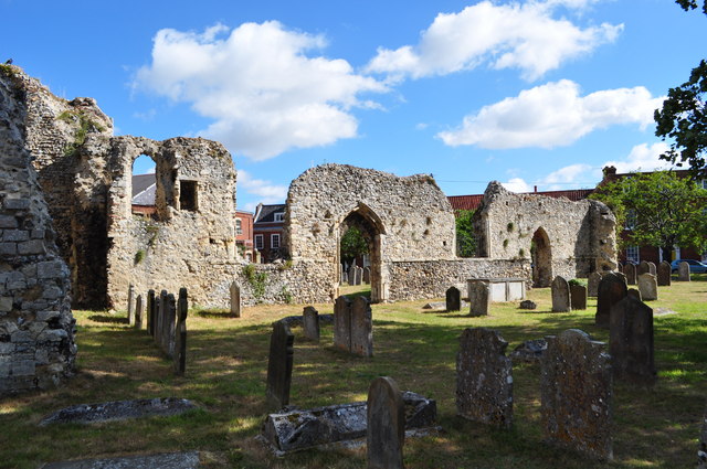
TM3389 : Bungay Priory (remains of)
taken 14 years ago, near to Bungay, Suffolk, England
Bungay is a small town in northern Suffolk. The origins of the town are Anglo Saxon, the land belonging to the tribe of Bonna, a Saxon chieftain. Due to its high position, protected by the River Waveney and marshes, the site was in a good defensive position and attracted settlers from early times. During the Roman occupation, Bungay was an important military station with a camp near Wainford and a Roman well in the nearby the Buttercross. Also various Roman artefacts have been found in the area (including coins near Clays printers). When the Romans returned to their own homeland in the early 5th century, Britain was invaded by Saxon tribes, and the extensive settlement at Bungay is indicated by the large burial site in the Joyce Road area dating from the 6th - 7th century. Also Saxon earthworks/defences near the castle.
Bungay Castle was built by the Normans, but was later rebuilt by Roger Bigod and his family, who also owned Framlingham Castle. There is the Norman church, Holy Trinity and the 12th century parish church of St. Mary was once the church of the Benedictine Priory (founded by Gundreda). The priory is in ruin, along with the castle. Most of the centre of Bungay was destroyed in 1688 by a major fire. Now the heritage feel means it is a conservation area and off the tourist trail.
 Map © Crown Copyright")
- Grid Square
- TM3389, 853 images (more nearby 🔍)
- Photographer
- Ashley Dace (more nearby)
- Date Taken
- Friday, 16 July, 2010 (more nearby)
- Submitted
- Friday, 16 July, 2010
- Subject Location
-
OSGB36:
 TM 337 897 [100m precision]
WGS84: 52:27.3455N 1:26.2940E - Camera Location
-
OSGB36: TM 336 897
- View Direction
- North-northeast (about 22 degrees)