2010
SD9492 : Benchmark on roadside rock
taken 14 years ago, near to Newbiggin, North Yorkshire, England
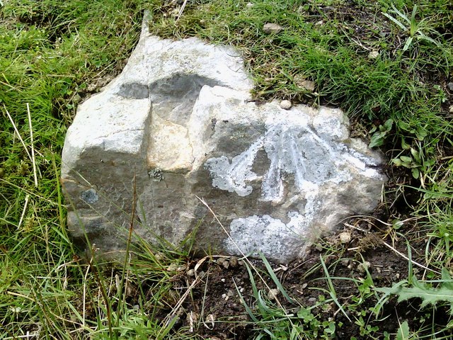
Benchmark on roadside rock
Ordnance Survey pivot benchmark on rock beside minor road near toposcope and track to Stackhill House. The pivot hole has acquired a rabbit's dropping! More information on the mark may be found on the Bench Mark Database at Link
 Map © Crown Copyright")
TIP: Click the map for more Large scale mapping
- Grid Square
- SD9492, 31 images (more nearby 🔍)
- Photographer
- Roger Templeman (more nearby)
- Date Taken
- Friday, 23 July, 2010 (more nearby)
- Submitted
- Sunday, 25 July, 2010
- Subject Location
-
OSGB36:
 SD 9467 9297 [10m precision]
WGS84: 54:19.9360N 2:5.0081W - Camera Location
-
OSGB36: SD 9467 9297
- View Direction
- WEST (about 270 degrees)