2010
TQ4254 : M25 past Clacket Lane Services
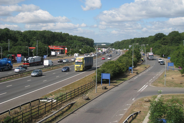
taken 14 years ago, near to Westerham, Kent, England
This is 1 of 2 images, with title M25 past Clacket Lane Services in this square
M25 past Clacket Lane Services
A notorious area of the M25 that often gets congested from heavy traffic on the M25 meeting traffic exiting the services. Looking West, with the South side services to the left.
Clacket Lane Services
Opened in 1993, Clacket Lane Services is a motorway services station between junctions 5 and 6 of the M25. It is one of the largest and busiest services on the UK motorway network.
Named after Clacket Lane from which it is adjacent, the land now bridges over the motorway and provides staff and emergency services exit.
There are two service areas, the North side serving the East bound anti clockwise and the South side serving the West bound clockwise of the motorway.
M25 Motorway
The M25 is a 117 mile orbital motorway that encircles London. It was constructed between 1975 and 1986.
The motorway is not a continuous loop as a section to the East of London at The Dartford Crossing is an A-Road.
Wikipedia; Link
 Map © Crown Copyright")
TIP: Click the map for more Large scale mapping
- Grid Square
- TQ4254, 82 images (more nearby 🔍)
- Photographer
- Oast House Archive (more nearby)
- Date Taken
- Wednesday, 28 July, 2010 (more nearby)
- Submitted
- Wednesday, 28 July, 2010
- Subject Location
-
OSGB36:
 TQ 422 545 [100m precision]
WGS84: 51:16.3513N 0:2.3054E - Camera Location
-
OSGB36: TQ 424 546
- View Direction
- West-southwest (about 247 degrees)