2010
TR3341 : Eastern Docks, Dover
taken 14 years ago, near to Dover, Kent, England
This is 1 of 8 images, with title Eastern Docks, Dover in this square
Eastern Docks, Dover
See more sizes for wider panorama.
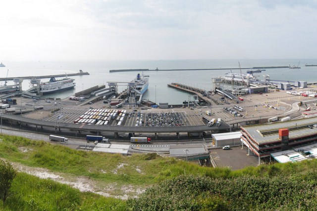
Dover Eastern Docks (Port of Dover)
Dover docks are possibly the busiest passenger port in the World. They carry 15 million passengers, 3/4 million HGVs and 120,000 buses & coaches annually. The docks have 9 berths. Four ferry companies operate out of the docks, P & O, Seafrance, Norfolk Lines and LD Lines. The docks are run by the Dover Harbour Board who were awarded their charter by James I in 1606. The docks are squeezed into land below the famous White Cliffs.
 Map © Crown Copyright")
TIP: Click the map for more Large scale mapping
- Grid Square
- TR3341, 391 images (more nearby 🔍)
- Photographer
- Oast House Archive (more nearby)
- Date Taken
- Saturday, 24 July, 2010 (more nearby)
- Submitted
- Wednesday, 28 July, 2010
- Subject Location
-
OSGB36:
 TR 334 416 [100m precision]
WGS84: 51:7.6133N 1:20.0981E - Camera Location
-
OSGB36: TR 332 419
- View Direction
- South-southeast (about 157 degrees)