2010
SZ0891 : Bournemouth: Gervis Place from above
taken 14 years ago, near to Bournemouth, Bournemouth, Christchurch & Poole, England
This is 1 of 2 images, with title Bournemouth: Gervis Place from above in this square
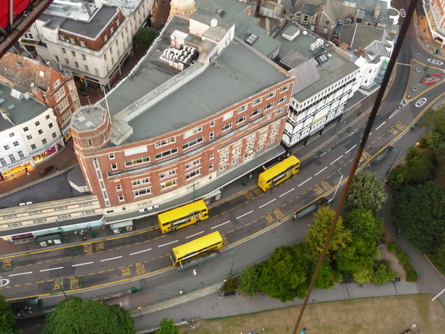
Bournemouth: Gervis Place from above
Looking down from SZ0891 : Bournemouth: the tethered balloon onto Gervis Place, the main bus road in the town centre where most of the arterial routes have their principal stops.
 Map © Crown Copyright")
TIP: Click the map for more Large scale mapping
- Grid Square
- SZ0891, 1884 images (more nearby 🔍)
- Photographer
- Chris Downer (more nearby)
- Date Taken
- Sunday, 18 July, 2010 (more nearby)
- Submitted
- Saturday, 14 August, 2010
- Subject Location
-
OSGB36:
 SZ 086 911 [100m precision]
WGS84: 50:43.1894N 1:52.7044W - Camera Location
-
OSGB36: SZ 086 911
- View Direction
- North-northeast (about 22 degrees)