2006
TA0577 : Wolds Way running parallel to Raven Dale
taken 18 years ago, near to Fordon, East Riding of Yorkshire, England
This is 1 of 6 images, with title starting with Wolds Way in this square
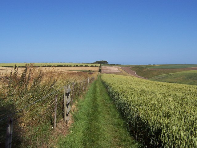
Wolds Way running parallel to Raven Dale
Raven Dale appears to be quite a shallow dry valley that is completely cultivated and covered by a barley crop. It deepens as we go east eventually entering Camp Dale. The green track carries the Wolds Way National Trail - the most under used in the country
The Wolds Way
A 79 mile route from Hessle on the Humber Estuary to Filey on the coast. The route follows the Chalk outcrop of the Yorkshire Wolds. Link

 Map © Crown Copyright")
TIP: Click the map for more Large scale mapping
- Grid Square
- TA0577, 26 images (more nearby 🔍)
- Photographer
- Chris Heaton (more nearby)
- Date Taken
- Thursday, 13 July, 2006 (more nearby)
- Submitted
- Friday, 14 July, 2006
- Subject Location
-
OSGB36:
 TA 054 774 [100m precision]
WGS84: 54:10.8937N 0:23.1899W - Camera Location
-
OSGB36: TA 053 774
- View Direction
- EAST (about 90 degrees)