2010
SD4798 : Barley Bridge Weir
taken 14 years ago, near to Staveley, Cumbria, England
This is 1 of 3 images, with title Barley Bridge Weir in this square
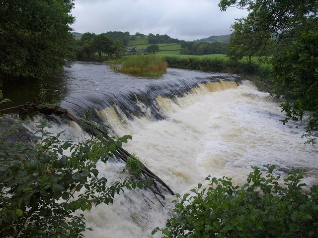
Barley Bridge Weir
Were it not for the leaves on the trees, you might imagine that the dates for this image and SD4798 : Barley Bridge Weir had been transposed. Here the Kent is in angry mood after a torrential day's rain.
 Map © Crown Copyright")
TIP: Click the map for more Large scale mapping
- Grid Square
- SD4798, 98 images (more nearby 🔍)
- Photographer
- Derek Harper (more nearby)
- Date Taken
- Friday, 20 August, 2010 (more nearby)
- Submitted
- Tuesday, 24 August, 2010
- Subject Location
-
OSGB36:
 SD 4700 9874 [10m precision]
WGS84: 54:22.8829N 2:49.0510W - Camera Location
-
OSGB36: SD 4700 9872
- View Direction
- NORTH (about 0 degrees)