2010
J3472 : Bandstand, Ormeau park, Belfast (2)
taken 14 years ago, near to Belfast, Co Antrim, Northern Ireland
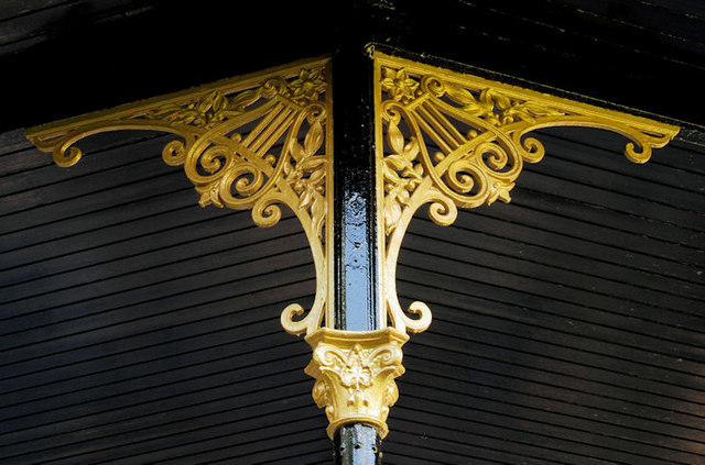
Bandstand, Ormeau park, Belfast (2)
See J3472 : Bandstand, Ormeau park, Belfast (1). The ironwork supporting the roof. Continue to J3472 : Bandstand, Ormeau Park, Belfast (2).
Ormeau Park, Belfast
A 100 acre park, between the Ormeau and Ravenhill Roads, originally part of the Donegall estate. Sold to Belfast Corporation in 1869 and opened as a park in 1871. The M4 (never built) would have cut through it.
Loading map... (JavaScript required)
- Grid Square
- J3472, 419 images (more nearby 🔍)
- Photographer
- Albert Bridge (more nearby)
- Date Taken
- Wednesday, 15 September, 2010 (more nearby)
- Submitted
- Wednesday, 15 September, 2010
- Subject Location
-
Irish:
 J 347 724 [100m precision]
WGS84: 54:34.9411N 5:54.9868W - Camera Location
-
Irish: J 347 724
- View Direction
- West-southwest (about 247 degrees)