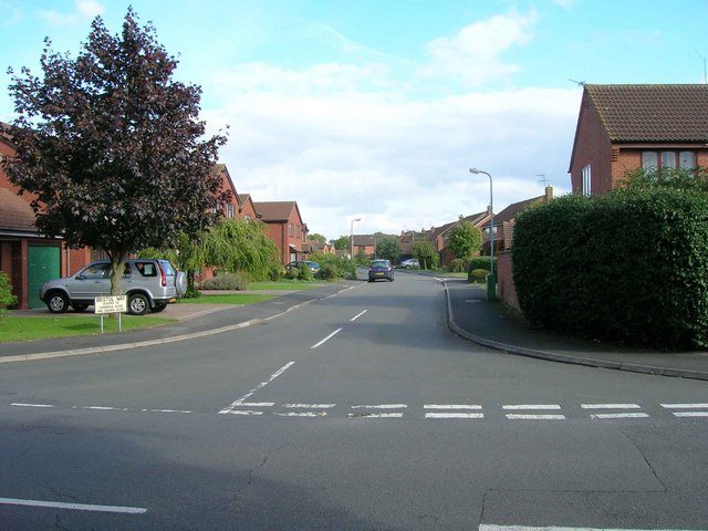
SP2754 : Bristol Way, Dovehouse Estate
taken 14 years ago, near to Wellesbourne, Warwickshire, England
During the late 1970s and early 1980s the Dovehouse estate was built on land that used to be part of Dovehouse Farm. The old farmhouse still exists at SP275545, with the housing estate surrounding it.
To the west of this area is situated Wellesbourne Mountford Airfield. This was constructed during WW2 on 200 acres of land which used to be part of Waterloo Farm, belonging to the Littler family. The farmhouse was situated at approximately SP268547, but no sign of it remains today, under the M40 Distribution Park Industrial Estate, which has been built on the eastern edge of the airfield. For more information on the history of the airfield see Link
When the housing estate was being built, the roads on it needed names. I have not discovered the details of the naming process, but I know that originally some roads had initial names with Shakespeare connections, i.e. Pembroke Gardens was Hathaway Gardens. Whatever the process, the final outcome was that the majority of the roads were named after aircraft connections, presumably with reference to the adjoining airfield. I have compiled an alphabetical list of the roads on the estate, with my interpretation of the derivation of the names.
Anson Close: Avro Anson - Military Transport. Link
Beaufort Close: Bristol Beaufort Bomber. Link
Blenheim Walk: Bristol Blenheim Bomber. Link
Bristol Way: Bristol Aeroplane Company. Link
Canberra Close: English Electric Canberra - Bomber / Photo-reconnaissance. Link
Cranwell Drive: RAF Cranwell - Air Base. Link
Crosslands: I dont know the derivation of this name.
Debden Close: RAF Debden Airfield. Link
Dovehouse Drive: Dovehouse Farm at SP275545 the original land for the estate.
Duxford Close: RAF Duxford Airfield. Link
Farrington Close: Named after Herbert and Theodora Farrington who were respectively on the Parish Council & Stratford District Council for 40 years, and the Parish Council for 25 years.
Gloster Gardens: Gloster Aircraft Company. Link
Halifax Close: Handley Page Halifax Bomber. Link
Hammerton Way: Named after the farmer Mrs Hammerton whose land spanned both sides of the River Dene from Kineton Road to Walton Lane.
Hampdon Way: Handley Page Hampden (road name spelled wrongly?). Link
Harvard Close: North American Harvard - Military Trainer Link
Home Furlong: This road is right by the old Dovehouse farmhouse. Is this an old reference to the furlong nearest home?
Hotchkiss Close: Named after the farmer Mr Hotchkiss who owned and worked Dovehouse Farm on which the Dovehouse Estate was built.
Lancaster Close: Avro Lancaster Bomber. Link
Lincoln Close: Avro Lincoln Bomber. Link
Lysander Close: Westland Lysander - Military Aircraft. Link
Manston Drive: RAF Manston Airfield. Link
Oxford Way: Airspeed Oxford - Military Trainer. Link
Pembroke Gardens: Hunting Percival Pembroke - Military Transport. Link
Redhill Close: RAF Redhill Airfield. Link
Sunderland Place: Short Sunderland - Flying Boat Bomber. Link
Valletta Way: Vickers Valetta - Military Transport (road name spelled wrongly?). Link
Waterloo Close: The old Waterloo Farm at SP268547 on which land the airfield was built.
Wellington Close: Vickers Wellington Bomber. Link
Whitworth Close: Armstrong Whitworth Aircraft Limited. Link
Wyvern Close: Westland Wyvern - Naval Fighter. LinkA wyvern is also a fire-breathing dragon used in medieval heraldry; had the head of a dragon and the tail of a snake and a body with wings and two legs. Quite appropriate for a fighter plane.
 Map © Crown Copyright")
- Grid Square
- SP2754, 174 images (more nearby 🔍)
- Photographer
- David P Howard (more nearby)
- Date Taken
- Monday, 20 September, 2010 (more nearby)
- Submitted
- Monday, 20 September, 2010
- Subject Location
-
OSGB36:
 SP 2733 5435 [10m precision]
WGS84: 52:11.2034N 1:36.0996W - Camera Location
-
OSGB36: SP 2731 5436
- View Direction
- East-southeast (about 112 degrees)