2010
SX8751 : St Saviour's church, Dartmouth: south side
taken 14 years ago, near to Dartmouth, Devon, England
This is 1 of 4 images, with title starting with St Saviour's church, Dartmouth in this square
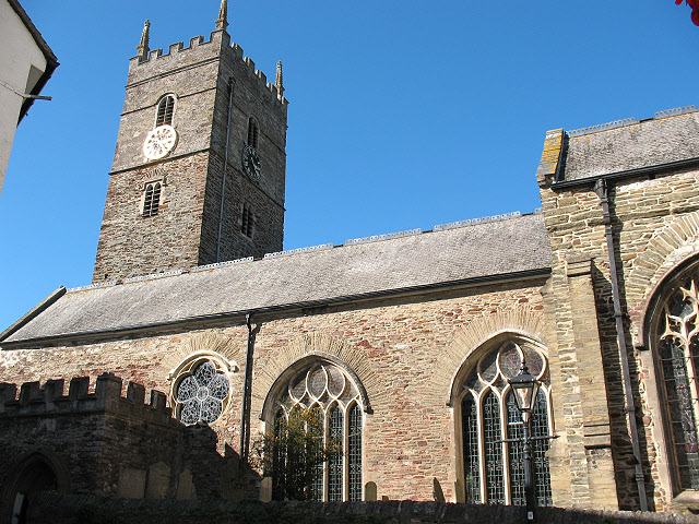
St Saviour's church, Dartmouth: south side
For other external views of the church see SX8751 : Dartmouth: parish church of St. Saviour and SX8751 : Tower, St. Saviour's church, Dartmouth.
St Saviour's church, Dartmouth
The parish church of Dartmouth in Devon, with early 14th century origins (or earlier: Jenkins describes it as founded in 1286, and there is a more detailed explanation at Link
) and dedicated in 1372 as a chapel of ease to the parish church of Townstal St Clement. The parish name is still 'Dartmouth St Clement (Townstal) with St Saviour and St Petrox'.
There was a major refurbishment in 1630-37 including raising the height of the tower, and a major internal reordering in the 1880s under architect E H Sedding, by which time Dartmouth was a naval training base. Listed grade I (List entry 1293197).
 Map © Crown Copyright")
TIP: Click the map for more Large scale mapping
- Grid Square
- SX8751, 1040 images (more nearby 🔍)
- Photographer
- Stephen Craven (more nearby)
- Date Taken
- Sunday, 26 September, 2010 (more nearby)
- Submitted
- Friday, 8 October, 2010
- Subject Location
-
OSGB36:
 SX 8776 5133 [10m precision]
WGS84: 50:21.0692N 3:34.7397W - Camera Location
-
OSGB36: SX 8777 5131
- View Direction
- North-northwest (about 337 degrees)