2010
TR0835 : Stile and Gate on Saxon Shore Way
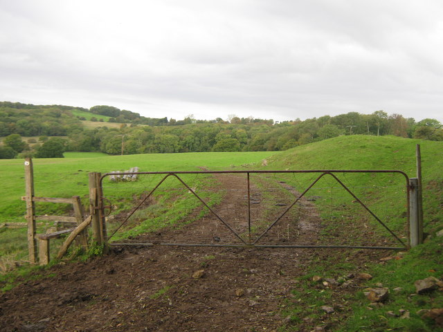
taken 14 years ago, near to Court-at-Street, Kent, England
Stile and Gate on Saxon Shore Way
A reverse view of TR0835 : Gate and stile on the Saxon Shore Way.
The long distance path leads from Honeypot Farm towards Dunk's Rough (in the background) and Curtis Wood. Knoll Hill is in the far background.
The long distance path leads from Honeypot Farm towards Dunk's Rough (in the background) and Curtis Wood. Knoll Hill is in the far background.
Saxon Shore Way
The Saxon Shore Way starts at Gravesend, Kent and traces the coast as it was in the Roman times as far as Hastings in East Sussex, 163 miles (262 km) in total. The Saxon Shore Way was originally opened in 1980, but has since been re-established, and in parts re-routed and extended. It follows the coastline of the South East as it was about 1500 years ago, long before the North Kent Marshes or the Romney Marsh came into existence. The Way takes its name, The Saxon Shore, from a line of fortifications built along the coastline as it was in the 3rd Century AD.
 Map © Crown Copyright")
TIP: Click the map for more Large scale mapping
- Grid Square
- TR0835, 18 images (more nearby 🔍)
- Photographer
- David Anstiss (more nearby)
- Date Taken
- Sunday, 17 October, 2010 (more nearby)
- Submitted
- Tuesday, 19 October, 2010
- Subject Location
-
OSGB36:
 TR 081 351 [100m precision]
WGS84: 51:4.6898N 0:58.2374E - Camera Location
-
OSGB36: TR 081 351
- View Direction
- West-northwest (about 292 degrees)