2010
SJ7503 : Grindleforge Bridge
taken 14 years ago, near to Grindle, Shropshire, England
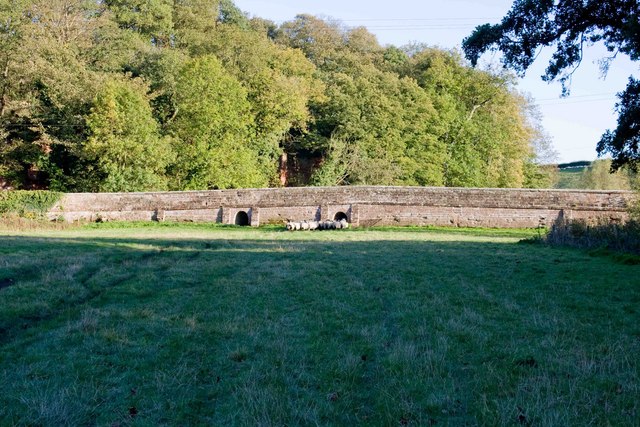
Grindleforge Bridge
The majority of the bridge structure forms a causeway across the Wesley Brook valley here. The arch that spans the Wesley Brook is just off to the right. The primary purpose of the two small arches is presumably to allow floodwater through, but they also provide access for sheep to the field beyond the bridge. At our approach the sheep escaped through the tunnel.
 Map © Crown Copyright")
TIP: Click the map for more Large scale mapping
- Grid Square
- SJ7503, 31 images (more nearby 🔍)
- Photographer
- Mike White (more nearby)
- Date Taken
- Wednesday, 20 October, 2010 (more nearby)
- Submitted
- Saturday, 23 October, 2010
- Subject Location
-
OSGB36:
 SJ 753 033 [100m precision]
WGS84: 52:37.6512N 2:21.9805W - Camera Location
-
OSGB36: SJ 752 034
- View Direction
- East-southeast (about 112 degrees)