2010
NO2476 : Glen Doll to Glen Clova
taken 14 years ago, 4 km WNW of Acharn, Angus, Scotland
This is 1 of 3 images, with title starting with Glen Doll in this square
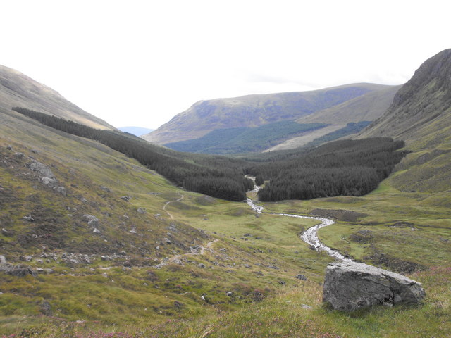
Glen Doll to Glen Clova
View of Glen Doll and White Water, the river in Glen Doll. Looking south east to Glen Clova. Jock's Road is on the left of the picture. Plantation planting which is being cleared at the moment. Classic U shaped glaciated glen, erratic (large boulder deposited by glacier) in foreground.
 Map © Crown Copyright")
TIP: Click the map for more Large scale mapping
- Grid Square
- NO2476, 22 images (more nearby 🔍)
- Photographer
- Dona Robbins (more nearby)
- Date Taken
- Saturday, 21 August, 2010 (more nearby)
- Submitted
- Tuesday, 2 November, 2010
- Subject Location
-
OSGB36:
 NO 244 769 [100m precision]
WGS84: 56:52.6438N 3:14.5025W - Camera Location
-
OSGB36: NO 237 775
- View Direction
- Southeast (about 135 degrees)