2010
NS4783 : Eastern side of old enclosure
taken 13 years ago, near to Craighat, Stirling, Scotland
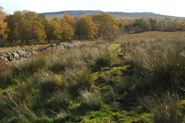
Eastern side of old enclosure
See NS4783 : Northern side of old enclosure for further comments.
As explained there, the enclosure is bounded on each side by a low ridge, in the form of an earthen bank. However, its eastern side is just part of a much longer ridge, a continuation of the one that is shown in NS4784 : Dry-stone wall. The enclosure simply projects from this ridge, and apparently dates from the same time period.
Note also the dry-stone dyke, which runs parallel to the ridge. Between the point shown in the present photograph, and the one shown at the link in the previous paragraph, a section of the dry-stone wall is offset by a few metres to the west (see the 1:25000 map), for a distance of about 360 metres.
That section of the dry-stone wall overlies the earthen ridge, which must therefore be older. The dry-stone wall is shown on the first-edition OS map (c.1865). The enclosure that is shown in the present photograph, and which is attached to the ridge, must likewise pre-date the dry-stone wall, despite not being included on OS maps before about 1922.
It is likely that the enclosure is, like the ridge to which it is attached, a part of the field system associated with a long-gone farmstead (for whose faint foundations, see the end-note). That farm is sufficiently old as not to be shown on any OS maps; its ruin (consisting only of grass-covered foundations) is not easy to spot today, and, even by the time of the first-edition OS map, it must already have been very indistinct.
Remains of an enclosure
This enclosure is shown on the 1:25000 map. OS maps of c.1922 label it a sheepfold. It measures about 90m (EW) by 55m (NS), and is located at the eastern end of a field system Link associated with a long-disappeared farmstead.
See Link for the faint foundations of the farmhouse with which that field system was associated, and see Linkfor an annotated satellite view.
 Map © Crown Copyright")
TIP: Click the map for more Large scale mapping
- Grid Square
- NS4783, 25 images (more nearby 🔍)
- Photographer
- Lairich Rig (more nearby)
- Date Taken
- Monday, 25 October, 2010 (more nearby)
- Submitted
- Thursday, 4 November, 2010
- Subject Location
-
OSGB36:
 NS 4768 8352 [10m precision]
WGS84: 56:1.2186N 4:26.7212W - Camera Location
-
OSGB36: NS 4766 8358
- View Direction
- South-southeast (about 157 degrees)